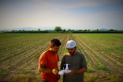
The Journal of Archaeological Science and Society for Archaeological Sciences Emerging Investigator Award 2019 has been awarded to GIAP-ICAC researchers Hèctor A. Orengo and Arnau Garcia Molsosa.
The prize is recognition to the paper “A brave new world for archaeological survey: Automated machine learning-based potsherd detection using high-resolution drone imagery” which will be available in open access for twelve months (https://doi.org/10.1016/j.jas.2019.105013).
The panel commended the visionary combination of drone-based photogrammetry, machine learning and parallel computing in an open-source environment, with the potential to revolutionise traditional field survey methods.
The purpose of this award is to promote and acknowledge research excellence among early-career scientists and provide an international venue for publication of significant work. The research must have a notable impact in the field of archaeological science.
The award-winning work exposes cutting-edge research in archaeological field surveying through the combination of machine learning techniques and high-resolution images captured by drones.
Drones become more prominent among surveying tools in Archaeology. They are used so far for getting good aerial views of sites and archaeological features, and even for discovering new archaeological settlements. New developments in the field of machine learning allow capturing full-resolution images with methods of pottery fragments (potsherds) collection.
The intensive pedestrian survey is one of the most widespread techniques used for the location of archaeological sites. Teams of archaeologists walk across a large area, recording and collecting items of material culture as potsherds. Introducing drones in the process can alleviate labour-intensive archaeological field surveying and reduce its costs.
Awarded researchers didn’t expect the prize at all! Take a look here to an interview by the Society for Archaeological Sciences.
The new archaeological surveying method proposed by Orengo and Garcia-Molsosa consists of flying a pre-programmed drone over the area of interest taking overlapping pictures which are joined together to create a single very large high-resolution image.
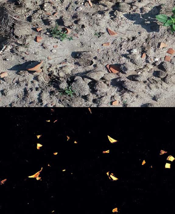
A machine learning (a subfield of Artificial Intelligence) algorithm powered by Google cloud computing infrastructure then identifies and maps all-ceramic fragments visible in the image. The algorithm uses colour and pixel texture to identify potsherds but can be trained to identify different types of material culture as well.
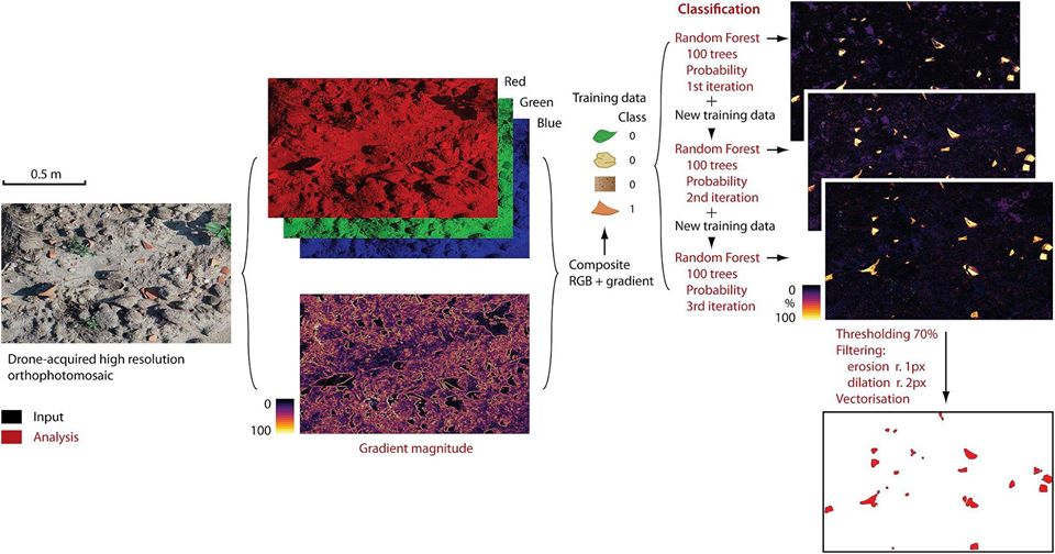
For the development of this test, the researchers have had the support of the FBBVA, which granted them the competitive BBVA Foundation Grant to Scientific Research Teams in Digital Humanities 2019.
It is the first time that this type of research has been done in archaeology. Not only it is the first time that sub-centimetre photogrammetry has been used with drones, but machine learning methods are also used to locate fragments of material culture, with results that improve traditional archaeological field surveying standards and reduce the time traditionally spent on it. In addition, code is available in open access so that everyone can use it.
The new technology introduces several advantages for archaeological field surveying: quickness, a much lower investment of funds, the ability to reevaluate the results with new methods, the ability to obtain quantitative parameters regarding visibility on the field and low-visibility conditions, ability to obtain geo-referenced results … Furthermore, results are not material densities but the exact shape of each pottery fragment (potsherd), a fact that opens up new interpretations for archaeological remains on the surface.
Related news:
Drone-Based Photogrammetry and AI for Automated Arch Survey – Ep 121. Archaeology Podcast Network.
“Archaeology in the sky (with drones)”, ICAC, October 11, 2019.
“GIAP successful in getting a competitive grant from FBBVA on Digital Humanities”, ICAC, March 26, 2020.


