During the past two months, a research team coordinated by Francesc C. Conesa (GIAP-ICAC) and Nuria Álvarez (Benahoarita Archaeological Museum, MaB) have been closely monitoring the ongoing volcano eruption at La Palma island in the Canary Islands.
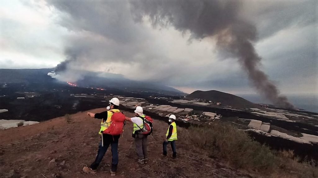
The team has accessed and surveyed the exclusion area next to the lava flows to map and document Cultural Heritage at risk of disappearing.
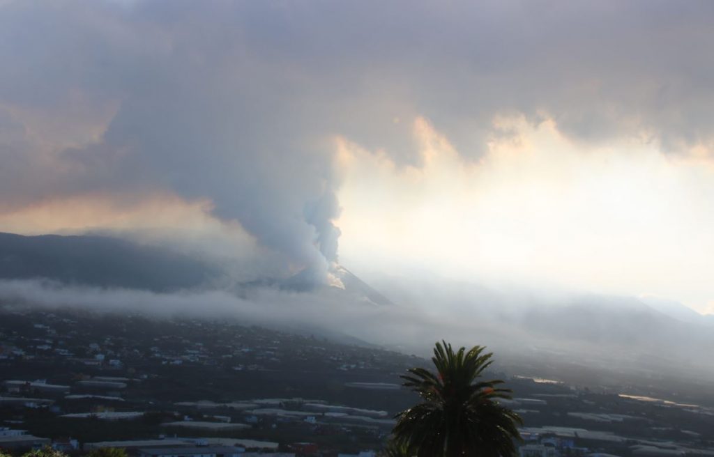
The eruptive activity began on the 19th of September 2021 in an area locally known as Cabeza de Vaca in the western part of the Cumbre Vieja volcanic ridge and expanded north and south of the Aridane Valley. At present, the eruptive activity has finally stopped but it is still considered active, and so far, the emerging lava flows have covered over 1200 hectares and destroyed more than 1600 buildings and related infrastructures such as roads and agricultural lands.
The three municipalities that have been under red warning and that were partially evacuated (Los Llanos, El Paso, and Tazacorte) have a rooted history of agro-pastoral land use and their cultural landscapes reflect the indigenous, historical, and more recent history of La Palma, ranging from pastoral lands to heavily anthropized agricultural plots dotted with hundreds of traditional Canarian housing.
However, as Conesa explains, “even though this is perhaps one of the most surveilled volcanic eruptions in recent times, little was known about the loss or potential loss of archaeological and ethnographic features and historical buildings, as the region had only limited or partial heritage inventories”.
“We urgently needed a rapid mechanism to systematically monitor the lava flows and the heavy ash deposition that threatened the visibility and preservation of known archaeological and historical sites”, Francesc C. Conesa continues.
To do so, the team uses legacy geospatial data, ranging from historical aerial imagery, toponymy, and cartography that predates the eruptive event to map the historical landscapes of the Aridane Valley even if many areas have already been lost.
Learn more details about these works in a Twitter thread posted by the GIAP researcher Francesc C. Conesa, where he explains how a group of archaeologists has continued to work within the La Palma volcano exclusion zone to document the cultural heritage threatened by lava flows and ash:
Ahora que el volcán de La Palma descansa, os contamos…
… cómo un grupo de arqueólogos continúa trabajando dentro de la zona de exclusión para documentar el Patrimonio Cultural amenazado por las coladas y la ceniza.
Con @GIAP_ICAC @invest_ull @IslasDeCultura
⬇️ Hilo 🧵 pic.twitter.com/fFmKsJTC6R
— Francesc C. Conesa (@fc_conesa) December 22, 2021
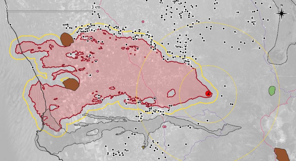
The remote assessment has also consistently used open and accessible geospatial data from the Copernicus Emergency Management Service rapid mapping service, which was activated during the first day of eruptive activity (code EMSR546) and has already produced more than 63 mapping products.
Moreover, the Government of La Palma has created a geospatial portal (Riesgo Volcánico) with daily updated drone imagery and other spatial information related to the volcanic and seismic activity in the area.

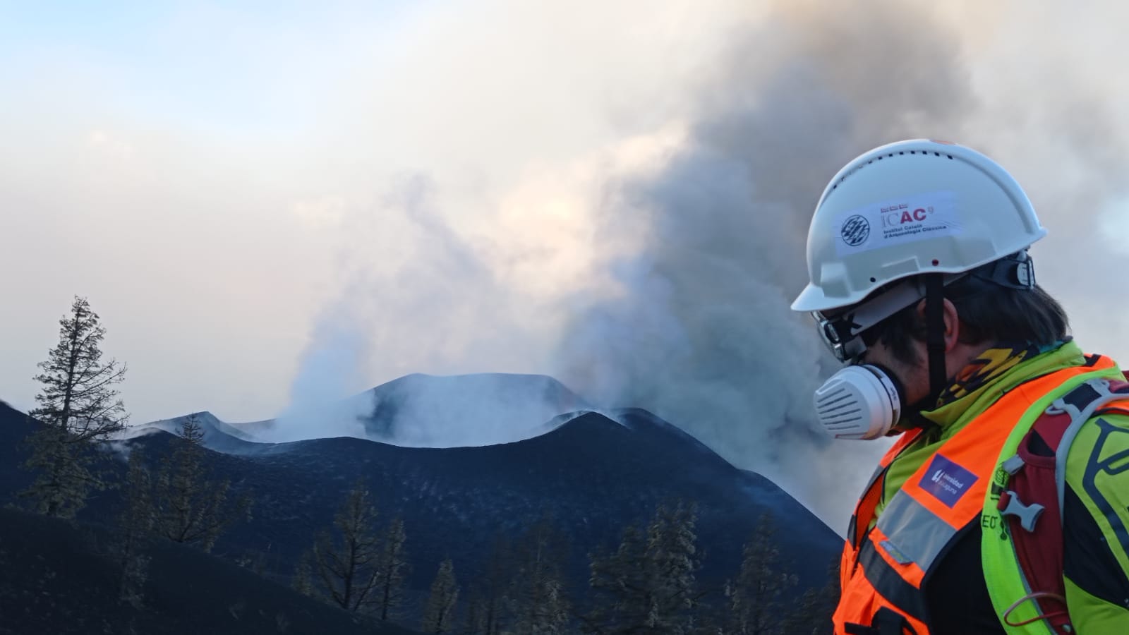
“We have combined the remote monitoring of the affected area with targeted field surveys and drone photogrammetry inside the evacuated area”, says Núria Álvarez (MaB).
Researchers strictly followed the security protocols of the Pevolca Scientific Committees, that is the Volcanic Emergency Plan that is supervising all the emergency and scientific actions in the volcano area. The survey team has been supervised by Prof. Ramón Casillas (University of La Laguna), a renowned volcanologist and member of Pevolca who has been working in the volcano area since the first day of the eruption.
“Our work in La Palma might contribute to advancing future guidelines and protocols for the remote monitoring and safeguarding of heritage at risk in the Canary Islands and in other similar scenarios elsewhere”, concludes Conesa. As the volcano consolidates its end and cools, the team is now preparing a research paper and planning the next field survey campaign in the volcano area.
Stay tuned to our websites (ICAC and GIAP) and social media (Twitter ICAC and GIAP) to know more about our work in La Palma!