A new breakthrough publication presents two algorithms for the large-scale automatic detection and instance segmentation of potential archaeological mounds on historical maps.
These results led to the detection of nearly 6,000 mound features across an expansive area of 470,500 square kilometers in the Indus River basin.
This remarkable achievement represents the most extensive application of such an approach to date and offers unprecedented opportunities for the reconstruction of ancient landscapes.
Over the past century, landscape modifications have been unprecedented, with the widespread implementation of mechanized agriculture, channel-based irrigation schemes, and urban expansion, among other factors. Historical maps provide a valuable glimpse into disappearing landscapes, depicting numerous historical and archaeological elements that no longer exist today.
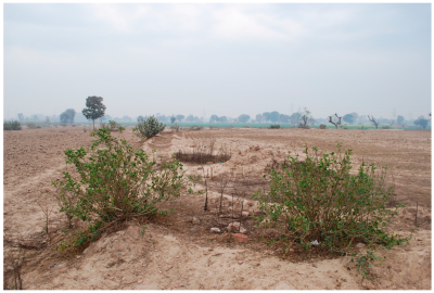
The algorithms primarily focus on identifying and extracting mound features that exhibit a high probability of being archaeological settlements. Mounds are among the most frequently documented archaeological features found in the Survey of India historical map series, even though they might not have been recognized as such during the original survey.
Mound features with significant archaeological potential are often depicted through hachures or contour-equivalent form lines. Consequently, the algorithms have been meticulously developed to detect each of these features. An innovative approach addresses two common challenges faced in automated archaeological surveys: the sparse distribution of archaeological features for detection and the limited availability of training data.
These algorithms have been successfully applied to various types of maps within the historic 1-inch to 1-mile series, which has increased the complexity of detection. Leveraging synthetic data and employing a “Curriculum Learning” strategy, the algorithms have achieved a better understanding of mound features’ visual characteristics.
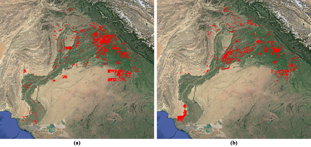
Additionally, a set of filters based on topographic setting, form, and size has been implemented to enhance the accuracy of the models. The resulting algorithms exhibit an impressive recall value of 66.96% and a precision of 96.25-88.51 % (for high and low-density areas respectively) for hachure mounds, as well as a recall value of 70.59 % and a precision of 100-92.31 % (for high and low-density areas respectively) for form-line mounds.
This breakthrough facilitated the detection of nearly 6,000 mound features across an expansive area of 470,500 square kilometers, marking the most extensive application of such an approach to date.
These remarkable algorithms represent a significant leap forward in the field of archaeological research and provide an invaluable tool for mapping and understanding ancient landscapes. The potential for uncovering previously unknown archaeological sites is immense, opening up new possibilities for scholars, historians, and archaeologists.
The study results from a collaboration between the Computational Archaeology Lab at the Catalan Institute of Classical Archaeology (ICAC-CERCA), The McDonald Institute of Archaeological Research of the University of Cambridge, and the Computer Vision Center (CVC-CERCA) of the Autonomous University of Barcelona.

Check out full reference, in open access:
Berganzo-Besga, I.; Orengo, H. A.; Lumbreras, F. et al. “Curriculum learning-based strategy for low-density archaeological mound detection from historical maps in India and Pakistan”, Sci Rep 13, 11257 (2023). https://doi.org/10.1038/s41598-023-38190-x
⬆️
The news echo these remarkable results, with an article in @LaVanguardia by @nachoorovio (in Spanish):
https://t.co/xrgSDo391i#ComputationalArchaeology #RemoteSensing #AncientLandscapeReconstruction— GIAP, Landscape Archaeology Research Group (@GIAP_ICAC) August 6, 2023
News originally posted, in English, at: https://giap.icac.cat/2023/08/06/mound-detection-from-maps/
The Catalan Institute of Classical Archaeology (ICAC-CERCA) is a CERCA center created as a consortium in 2003 by the Generalitat de Catalunya (Catalan government) and the University Rovira i Virgili. It is based in Tarragona, a city recognized as a World Heritage Site by UNESCO in 2000 and specializes in advanced research and training in classical archaeology. More information at www.icac.cat/en


