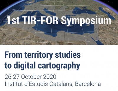
1st TIR-FOR Symposium. From territory studies to digital cartography
Next October 26 and 27, will take place the 1st TIR-FOR Symposium, at the IEC, Institut d’Estudis Catalans (Barcelona), in a fully online format.
The Symposium will run a two-day program with 27 talks and a poster session, organized into three thematic sessions; with the participation of experts from more than twenty research centres and institutions, at an international level.
A unique opportunity to know first-hand the great possibilities offered by digital cartography, which has become an essential tool for research and the dissemination of knowledge about the Roman world. The symposium wants to promote the creation of international networks among the different research groups and reach consensus on the cartographic translation of the elements studied, make a joint assessment of the on-going research and offer a forum for dialogue.
It will also play a relevant role in the reflection on the huge potential offered by linked open data. Settlement and communication networks studies, toponymy and archaeological topography, as well as territory and landscape studies, requires commonly agreed on methodologies to allow interaction and collaborative construction of the Roman world maps.
Don’t miss the 1st TIR-FOR Symposium (next October, 26 & 27), organized by the International TIR-FOR Commission: an event to encourage reflection and discussion regarding the inextricable interaction between research into settlement, territory and archaeological topography and digital cartography.
PROGRAM
MONDAY, 26th OCTOBER 2020
- 8:30 h Opening: Joandomènec Ros, president of the Institut d’Estudis Catalans, and Josep Guitart, president of the TIR-FOR International Commission.
SESSION 1. PRESENT AND FUTURE OF THE INTERNATIONAL TIR-FOR PROJECT
CHAIR: Josep Maria Palet (Catalan Institute of Classical Archaeology, ICAC).
- 8:40 h. Talk. “The new digital TIR-FOR project”. Marta Prevosti (ICAC-IEC), Pau de Soto (ICAC), Núria Romaní (ICAC – Autonomous University of Barcelona, UAB), Ada Cortés (Sapienza University of Rome – ICAC) and Josep Guitart (IEC).
- 9:10 h. “International World Map: a history spanning centuries”. Luisa Migliorati, Laura Ebanista and Ilaria Trivelloni (Sapienza University of Rome).
- 9:40 h Coffee break
- 10:00 h. “TIR-FOR Romania. State of research”. Florin-Gheorghe Fodorean (Babeș-Bolyai University).
- 10:30 h. “Mapping the barbarian world – outline of the issues”. Judyta Rodzińska (Jagiellonian University).
- 11:00 h. “From map to gazetteer and back again”. Georgios Zachos (Academy of Athens, Research Centre for Antiquity) and Vyron Antoniadis (National Hellenic Research Foundation, Institute of Historical Research).
- 11:30 h. “Le projet TIR-FOR et la Carte Nationale des Sites Archéologiques et des Monuments Historiques”. Fathi Bejaoui and Moèz Achour (National Institute of Heritage, Tunisia).
- 12:10 h. DISCUSSION
SESSION 2. DIGITAL MAPS OF THE ROMAN WORLD AND SPECIALISED APPLICATIONS
CHAIR: Luisa Migliorati (Sapienza University of Rome)
- 12:40 h. Talk. “Digital Maps and historical gazetteers: function and importance for digital historical research”. Johan Åhlfeldt (University of Gothenburg).
- 13:25 h. DISCUSSION
- 13:40 h Lunch
CHAIR: Florin-Gheorghe Fodorean (Babeș-Bolyai University)
- 15:00 h. “From ‘Flatland’ to the real world. Archaeological mapping in the digital age”. Jacopo Turchetto (University of Padua).
- 15:30 h. “Reconstructing Medieval Landscapes: the Austrian Research Project Tabula Imperii Byzantini and its Work in Western Anatolia”. Andreas Külzer (Austrian Academy of Sciences, Division of Byzantine Research).
- 16:00 h. “AdriAtlas – Atlas informatisé de l’Adriatique antique”. Francis Tassaux (Ausonius Insititute –Bordeaux Montaigne University).
- 16:30 h. “Aquitaviae, projet de carte dynamique participative des voies de l’Aquitaine romaine”. Clement Coutelier and François Didierjean (Ausonius Insititute – Bordeaux Montaigne University).
- 17:00 h. “Viator-e. The roads of the Western Roman Empire”. Pau de Soto (ICAC).
- 17:30 h. Coffee break
- 18:00 h. POSTER SESSION
CHAIR: Núria Romaní (ICAC-UAB)
POSTERS
- “Digital resources for mapping the population movement in the Roman Empire”. Jesús Ignacio Jiménez Chaparro and Alicia Ruiz Gutiérrez (University of Cantabria, Group AHIR).
- “Multi-sensor and multi-temporal mapping of the Roman city of Pollentia (Alcúdia, Mallorca): the ARCHREMOTELANDS project approach”. Eduard Angelats (Technological Centre of Telecommunications of Catalonia, CTTC/CERCA – Geomatics division), Francesc C. Conesa (ICAC), Catalina Mas Florit (University of Barcelona, UB – Archaeological and Archaeometric Research Group, ERAAUB), Marc Salom (independent researcher), Miguel Ángel Cau Ontiveros (UB- ERAAUB).
- “Big Earth Data and multi-temporal vegetation trends in north-western Mallorca: implications for the optimal monitoring of archaeological cropmarks”. Francesc C. Conesa (ICAC), Eduard Angelats (CTTC/CERCA – Geomatics division), Catalina Mas Florit (UB-ERAAUB), Agustin Lobo (Institute of Earth Sciences Jaume Almera – CSIC), Miguel Ángel Cau Ontiveros (UB-ERAAUB).
- “The contribution of the digital cartography to the reconstruction of the ancient walls of Brundisium“. Giovanna Cera (University of Salento).
- “La lettura del paesaggio antico per la definizione dell’Ager Hatrianus interno. Il pagus di Cellino Attanasio”. Davide Mastroianni (Gruppo di Ricerca per il Mezzogiorno Medievale, GRIMm).
TUESDAY, 27th OCTOBER 2020
SESSION 3. STUDIES OF LANDSCAPE, SETTLEMENT AND ARCHAEOLOGICAL TOPOGRAPHY AND DIGITAL CARTOGRAPHY
CHAIR: Georgios Zachos (Academy of Athens, Research Center for Antiquity)
- 8:30 h. Talk. “Análisis del paisaje integrado: más allá de la distribución de yacimientos”. Hèctor A. Orengo and Josep M. Palet (ICAC, Research Group GIAP).
- 9:15 h. DISCUSSION
- 9:25 h. “Landscape archaeology in northern Dacia. Potaissa and its surroundings”. Florin-Gheorghe Fodorean (Babeș-Bolyai University).
- 9:55 h. “Geospatial-economic studies and archaeological data analysis applied to ancient viticultural landscapes. The case of Laetanian Roman wine, Hispania Citerior Tarraconensis“. Antoni Martin Oliveras and Victor Revilla (UB-CEIPAC), Lisa Stubert (University of Potsdam – Institute of Environmental Sciences and Geography) and Sebastian Vogel (Leibniz Institute for Agricultural Engineering and Bioeconomy, ATB).
- 10:25 h. Coffee break
CHAIR: Judyta Rodzińska (Jagiellonian University)
- 10:45 h. “Assentaments militars romans del nord-est de la Hispania Citerior (Catalunya i la vall de l’Ebre) en les primeres etapes de la romanització. Estudi del cas i proposta de caracterització i identificació”. Laia Catarineu (UAB).
- 11:15 h. “La realización de mapas de densidades para la investigación del poblamiento antiguo. El entorno del Bajo Guadalquivir (SO de España) entre los siglos II y IV d. C. como caso de estudio”. Luis-Gethsemaní Pérez-Aguilar (Institute of Archaeology – Merida, CSIC – Junta de Extremadura).
- 11:45 h. “Dehesa de Bolaños y Cortijo de Frías. Análisis histórico-arqueológico e interpretación de su paisaje en época romana”. Francisco Javier Catalán González (University of Cadiz).
- 12:15 h. “The Calore river: Settlements and Roads in the Roman Time”. Pierfrancesco Izzo (independent researcher) and Giuseppina Renda (University Campania Luigi Vanvitelli).
- 12:45 h. “The territory of Roman Barcino: methodological advances applied to the study of a centuriated landscape”. Josep Maria Palet (ICAC), Maria Jesús Ortega (ICAC) and Carme Miró (Archaeological Service of Barcelona).
- 13:15 h. Lunch
CHAIR: Ada Cortés (Sapienza University of Rome – ICAC)
- 14:45 h. “Rescue archaeology data and GIS redefining a classical town: The Roman city of Palma (Mallorca, Balearic Islands) “. Bartomeu Vallori Márquez (UB-ERAAUB).
- 15:15 h. “Modellazione e analisi dei geodati per la ricostruzione del paesaggio di Privernum (Priverno, Lazio, Italy)”. Francesca Carinci (Sapienza University of Rome) and Antonio Leopardi (University of Salento).
- 15:45 h. “Munigua (Villanueva del Río y Minas, Sevilla)”. Thomas Schattner (German Archaeological Institute).
- 16:15 h. “Peltuinum. City and landscape between tradition and new techniques”. Dario Canino and Alessandro Vecchione (Sapienza University of Rome).
- 16:45 h. Coffee break
CHAIR: Pau de Soto (ICAC)
- 17:05 h. “Las vías pecuarias medievales del Baix Montseny y el método del camino óptimo”. Marc Ferrer Fernández (UB).
- 17:35 h. “Factors de localització de les comunitats monàstiques del Penedès medieval”. Marçal Díaz Ros (UB).
- 18:05 h. “Integrating historical cartography, written accounts and satellite images for the reconstruction of past landscapes: the case of Madayi (Kerala, India)”. Marco Moderato (D’Annunzio University of Chieti–Pescara).
- 18:35 h. CLOSING REMARKS BY SYMPOSIUM CHAIR
Download full program


