El proyecto Tarraco 360° recoge el trabajo científico del grupo de investigación SETOPANT (URV/ICAC) y lo convierte en un recorrido virtual que permite visitar los monumentos Patrimonio de la Humanidad de la ciudad de Tarragona en 3D.
«Tárraco a través del tiempo»
Actualmente, el recorrido cuenta con 6 monumentos, 36 panorámicas 360º y 75 puntos con información detallada.
Accediendo a cada monumento se puede descubrir la ciudad romana a vista de pájaro, con los siguientes escenarios: la ciudad, Teatro, Foro de la Colonia, el territorio, Torre de los Escipiones, Arco de Berà.
En cada uno de estos mapas se indica la localización de las diferentes panorámicas virtuales disponibles: el botón 360º, que te lleva a recorrer los monumentos y descubrir su interior.
En algunos casos, también, se puede ver la panorámica de la ciudad actual desde el mismo punto. Hay 75 puntos de interés marcados en los que se puede consultar información adicional de los monumentos.

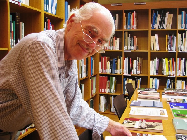
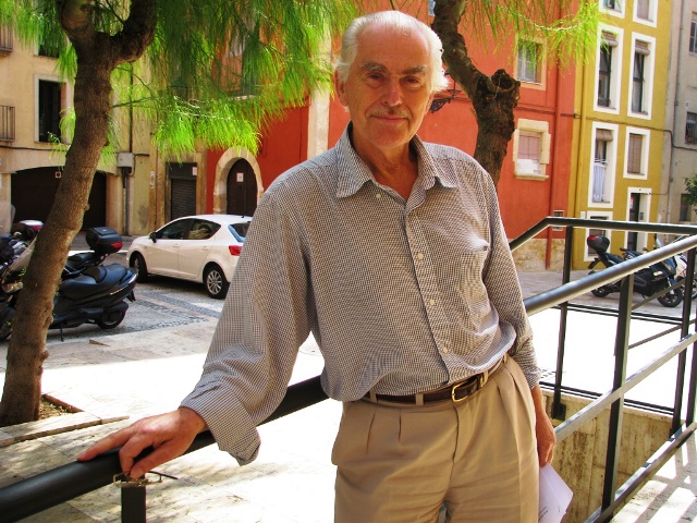
Miembros del equipo científico del proyecto: Ricardo Mar (URV), Joaquín Ruiz de Arbulo (URV-ICAC), David Vivó (UdG), Marc Lamuà (Setopant), José-Alejandro Beltrán-Caballero (Setopant), José-Javier Guidi (Setopant), Ferran Gris (Setopant, investigador adscrito del ICAC).
Con el patrocinio de Fundació Privada Mútua Catalana.
La ciudad
La civitas (ciudad) romana de Tárraco se extendía entre la desembocadura del rio Francolí, el perfil litoral del Mediterráneo y el promontorio de la actual Parte Alta o núcleo histórico. El origen de la civitas está en el oppidum (poblado) íbero de Kesse y el gran campamento militar romano de los siglos III-II a.C. A partir del siglo I a.C. el núcleo urbano ostentará el título de colonia, será residencia del mismo Augusto, ejercerá la capitalidad de una de las provincias más extensas del imperio y aglutinará una activa y dinámica actividad comercial y política. Esta progresiva relevancia de Tárraco en el Mediterráneo occidental impulsará y moldeará su paisaje urbano.
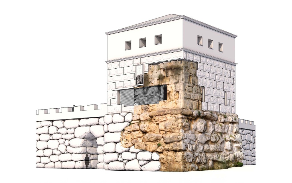
Puntos de interés: Trama urbana, Muralla, Torre de Minerva, Gran colector, Suburbio, El Puerto.
Teatro
El teatro de Tárraco fue construido entorno al año 10 a. C., y su abandono debe situarse a finales del siglo II d. C. El edificio acogía diversas fiestas anuales que comprendían espectáculos escénicos, danzas, cantos corales y representaciones de los más variados géneros (comedias, recitationes, canciones, pantomimos…). El teatro era, en definitiva, un espacio de encuentro y de comunión cívica para los ciudadanos romanos de Tárraco, un lugar común en el que poder expresar la adscripción de la sociedad al estado en el que las manifestaciones más profanas se imbricaban con las religiosas, como el culto imperial.
Puntos de interés: Altar dedicado al culto imperial, Marmolización, Ciclos escultóricos, Fachada posterior, Fachada escénica, Elementos arquitectónicos, Ninfeo, Tribunas, Muros radiales, Restos conservados, Velum.
Foro de la Colonia
El foro de la colonia se extendía en la parte baja de la ciudad romana. Se trataba de un conjunto de edificios y plazas porticadas que se sucedían y que alojaban el culto religioso, las actividades jurídicas y políticas, el comercio… en definitiva, el auténtico centro neurálgico de la colonia. El inicio de este espacio hay que situarlo a finales de la República (I a. C.), con una vida dinámica que llegaría hasta mediados del siglo IV d. C., cuando se documenta el derrumbe de algunos de los edificios.
Puntos de interés: La Basílica, Plaza Porticada, Restos arqueológicos, Aedes Augusti, Altar de las victorias de Augusto, El erario, La plaza del Capitolio, El Capitolio, Las 3 fases del Capitolio, Excavaciones del Capitolio.
El territorio
El campo, el mundo rural, al igual que la ciudad, obedecía a una estricta organización y gestión en el mundo romano. En el caso de Tárraco, los arqueólogos han podido identificar una red de parcelas ortogonales que se extendían por el territorio (ager Tarraconensis). Cada lote de estas parcelas debió de ser entregado a miembros del ejército a fin de que se retiraran y se instalaran como colonos en la región, potenciando las actividades agrícolas e incentivando el comercio. Villas, granjas, puentes, señalizaciones, calzadas… jalonaban este paisaje rural parcelado.
Puntos de interés: Vía Augusta, Torre de los Escipiones, Arco de Berà, Acueducto de Les Ferreres, Centcelles, Els Munts.
Torre de los Escipiones
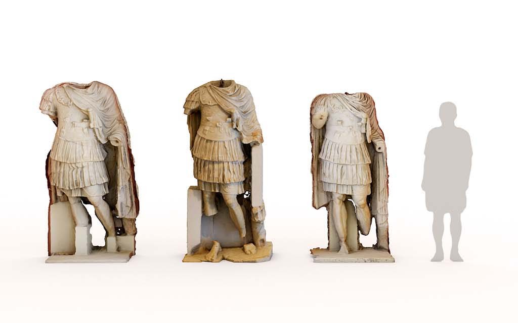
En un excelente estado de conservación, la denominada torre de los Escipiones es en realidad un mausoleo turriforme monumental. La estructura, que estaría rematada en una cubierta piramidal, pintada y decorada con relieves todavía hoy visibles, alojaría el enterramiento de un importante miembro de la sociedad tarraconense. Su situación junto a la Via Augusta responde a la legislación romana que prohibía enterrar dentro de las ciudades.
Puntos de interés: Arquitectura, Atis, Inscripción monumental, Inscripción desaparecida, Bajorrelieve.
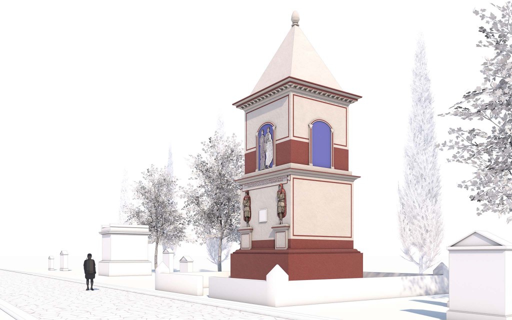
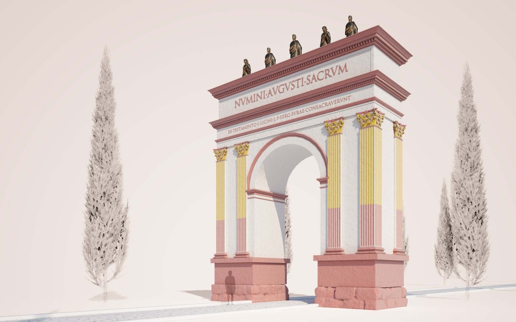
Arco de Berà
Presidiendo el paso de la Via Augusta, se erige el arco de Berà. Se trata de un arco honorífico de dimensiones considerables que ha sido reformado y transformado a lo largo del tiempo. El arco posee un epígrafe laudatorio cuya dedicatoria hace referencia a Lucius Licinius Sura, un miembro de la élite tarraconense originario de Celsa (Aragón) que contó con el apoyo imperial para erigirlo. Este tipo de arcos tenía un valor sagrado y se construían en lugares relevantes, como los límites de dos propiedades, la existencia de un puente o un río, etc.
Puntos de interés: Arquitectura, Inscripción, Restitución, Historiografía.