Search Results for: trama
Prefaci. Deu anys de recerca i docència conjunta/Prefacio. Diez años de investigación y docencia conjunta
El Circ romà de Tarragona. Monument i ciutat
Presentació del llibre “El Circ romà de Tarragona. Monument i ciutat”
Ens plau de presentar-vos l’obra El Circ romà de Tarragona. Monument i ciutat. Una publicació digital feta amb molta cura i dedicació, i que, a més, compta amb un conjunt de dades en obert que també posem a disposició de la comunitat científica i tota persona interessada.
Hem preparat un acte de presentació molt especial! Amb la participació de Josep Maria Macias (MIRMED), Lydia Gil (ICAC), Pau Jansà Olivé (arquitecte) i els autors del llibre. I podreu seguir-nos en directe, en aquest enllaç, el proper 15 de març a partir de les 19 h.
L’investigador Josep Maria Macias, del grup de recerca MIRMED, farà una petita presentació a partir del tema “El Circ de Tarraco, un repte col·lectiu”.
La responsable del programa de ciència oberta a l’ICAC, Lydia Gil, ens parlarà de “Dades de recerca obertes, una aposta ferma de l’ICAC”.
L’arquitecte Pau Jansà ens farà la presentació “Des de l’espina…”.
Després, els autors de l’obra (Josep Maria Macias, Josep Maria Puche, Pau Solà-Morales, Josep Maria Toldrà, Ivan Fernández, Anna Ferré i Josuè Andreu) obriran un debat sobre la publicació, l’arquitectura romana, el Circ romà de Tarraco i altres temes relacionats. Us animeu a participar-hi? Us hi esperem!
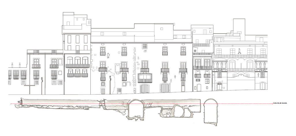
El llibre El Circ romà de Tarragona. Monument i ciutat és fruit d’un projecte docent i de recerca desenvolupat per membres de l’Institut Català d’Arqueologia Clàssica (ICAC) i de l’Escola Tècnica Tècnica d’Arquitectura (ETSA) de la Universitat Rovira i Virgili (URV). Ambdues institucions s’han unit per crear un espai de treball interdisciplinari que dota la docència i la recerca universitàries d’una personalitat pròpia.
Alumnat i professorat han participat en la documentació i anàlisi del Circ romà de Tarragona, creant una obra singular i d’interès tant per al públic especialista com general.
Amb una superfície de quatre hectàrees, l’omnipresència del Circ romà de Tarragona converteix aquest monument en una realitat patrimonial immanent a una part significativa del centre històric contemporani de la ciutat. Des del segle V, el Circ ha experimentat un procés de transformació que, des del punt de vista urbanístic, va acabar al segle XIV amb l’expansió de la ciutat.
El Circ romà de Tarraco és un excel·lent cas pràctic amb què desenvolupar aquesta estratègia d’aprenentatge i experimentació metodològica. Resultat de 1900 anys d’història, permet entendre l’aparició de la ciutat actual com a resultat d’un procés involuntari de determinisme urbanístic.
Podem identificar i entendre la ciutat medieval, moderna o contemporània de Tarraco a partir de la identificació del substrat del Circ romà.
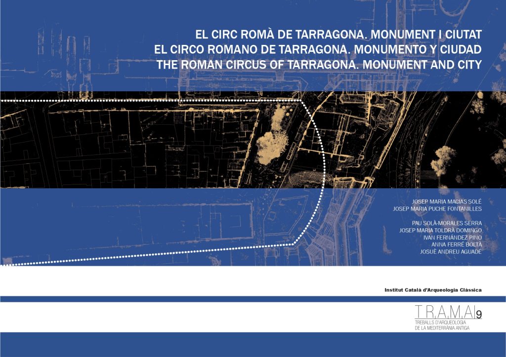
El Circ romà de Tarragona. Monument i ciutat
Aquest llibre és fruit d’un projecte docent i de recerca desenvolupat per membres de l’Institut Català d’Arqueologia Clàssica (ICAC) i de l’Escola Tècnica Tècnica d’Arquitectura (ETSA) de la Universitat Rovira i Virgili (URV). Ambdues institucions s’han unit per crear un espai de treball interdisciplinari que dota la docència i la recerca universitàries d’una personalitat pròpia.
Alumnat i professorat han participat en la documentació i anàlisi del Circ romà de Tarragona, creant una obra singular i d’interès tant per al públic especialista com general.
Podem identificar i entendre la ciutat medieval, moderna o contemporània de Tarraco a partir de la identificació del substrat del Circ romà.
El Circ romà de Tarraco és un excel·lent cas pràctic amb què desenvolupar aquesta estratègia d’aprenentatge i experimentació metodològica. Resultat de 1900 anys d’història, permet entendre l’aparició de la ciutat actual com a resultat d’un procés involuntari de determinisme urbanístic.
Continguts:
- Prefaci. Deu anys de recerca i docència conjunta (https://doi.org/10.51417/trama_9_00)
- El Circ, ahir i avui. Un repte polièdric antic (https://doi.org/10.51417/trama_9_01)
- El Circ, element urbà (https://doi.org/10.51417/trama_9_02)
- El Circ dibuixat (https://doi.org/10.51417/trama_9_03)
- El Circ, monument urbà (https://doi.org/10.51417/trama_9_04)
- The Roman Circus of Tarragona (textos en anglès) (https://doi.org/10.51417/trama_9_05)
- Llista de figures i bibliografia (https:doir.otg/10.51417/trama_9_06)
Documentació digitalitzada, restes arqueològiques i entorn urbà
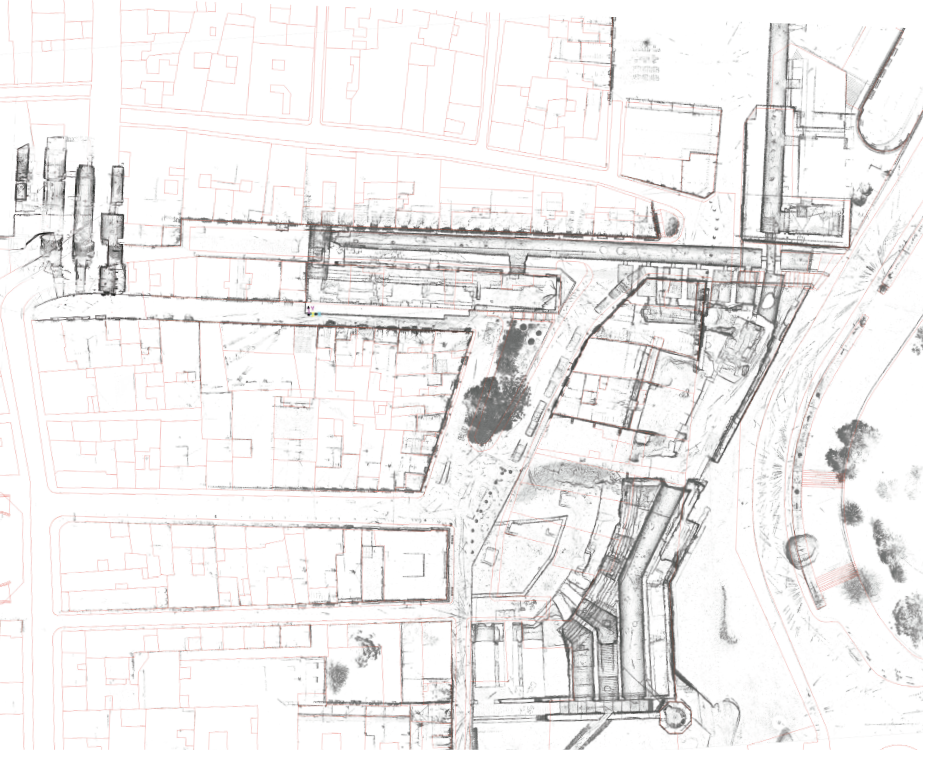
Al llarg de diversos projectes de recerca, l’equip de l’ICAC dirigit per Josep Maria Macias ha escanejat tot l’entorn urbà del Circ de Tarragona, en col·laboració amb l’ETSA, Escola Tècnica Superior d’Arquitectura de la URV. El treball de digitalització inclou el monument del Circ, la Muralla, la Torre de les Monges, a més d’altres indrets propers del centre històric de Tarragona o el proper conjunt monumental de l’Amfiteatre.
Els arxius dels núvols de punts estan ara a lliure disposició de qualsevol persona perquè les pugui fer servir per als seus propis estudis o projectes.
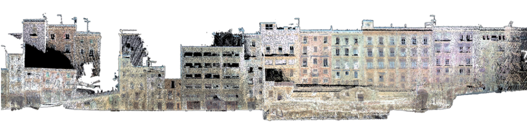
A més de la vista aèria de les restes arqueològiques, s’ha documentat també l’entorn urbà dels monuments, de manera que s’han escanejat les façanes de les cases que actualment hi ha construïdes, el subsol dels edificis i altres parts no visibles o no accessibles des de l’exterior.
Els núvols de punts creats a partir de l’escanejat làser creen un espai tridimensional ple de referències amb què crear un dibuix o fer una reconstrucció virtual tant de les restes romanes associades al Circ i la Muralla de Tarragona com de la trama urbana de la Part Alta.
Consulta aquí el dataset Digitisation of the Roman Circus of Tarragona. 3D point clouds.
El conjunt d’informació que s’ha obtingut és un treball d’informació molt complet que reflexa la realitat de la trama urbana de la Part Alta de Tarragona.
La informació que conté aquesta dataset és semblant a la informació que genera el LIDAR i que podem trobar, per exemple, a l’Institut Català de Cartografia (ICC). En el cas de les dades de l’ICAC, però, s’arriba a una precisió de centímetre!
L’explotació d’aquestes dades poden resultar molt útil per a diversos col·lectius: personal tècnic i de recerca, administracions i entitats vinculades a la conservació del patrimoni i l’urbanisme, restauradors, empreses de modelatge virtual i 3D…
Una visió diacrònica del patrimoni arquitectònic i arqueològic
Els escanejos i captura de dades s’han fet en diversos moments, des de 2013, de manera que en alguns casos podem veure com ha evolucionat l’edifici. Per exemple, en el cas de l’Amfiteatre de Tarragona, de què l’ICAC ha fet escanejos el 2013 i el 2017, es pot fer una comparativa dels dos escanejos i veure quines diferències es donen entre els dos moments de captura i, per tant, detectar possibles moviments que s’hagin produït en l’edifici. A més de amb l’Amfiteatre, aquesta comparativa també es podria fer en els casos de la Muralleta medieval, la Torre del Pretori i del Circ, de què l’ICAC disposa de diversos escanejats.
D’aquesta manera, els núvols de punts disponibles no responen a un únic moment sinó que permeten tenir una visió diacrònica de l’arquitectura romana a la Part Alta de Tarragona. Una possible utilitat d’aquests dades seria, per tant, el monitoratge del patrimoni arquitectònic i arqueològic.
La comparativa entre escanejos fets en diferents anys permet veure l’evolució dels edificis.
Al llarg dels anys, els treballs d’escaneig ha comptat amb la col·laboració de l’Ajuntament de Tarragona (que ha permès a l’ICAC accedir als espais) i també de l’ETSA, Escola Tècnica Superior d’Arquitectura de la URV que, sota la coordinació del Dr. Josep Maria Toldrà, imparteix una assignatura sobre intervenció en patrimoni arquitectònic (del Grau en Arquitectura de la URV) en col·laboració amb l’ICAC, en què els alumnes s’introdueixen en les bases de la restauració arquitectònica i prenen coneixement de les tècniques de documentació gràfica per a la restauració arquitectònica.
A cultural grant allows the ICAC an action on scientific knowledge dissemination
The ICAC has a Publications Service, coordinated by Maura Lerga, through which spread its own and others’ research work in the field of classical archeology.
So far, more than 120 titles have been published within the Documenta, Hic et nunc, Trama series and co-editions and collaborations with other institutions.
On the other hand, from the ICAC Documentation Centre and Library, a strong boost has been given from the beginning to bibliographic exchange agreements with universities and scientific institutions around the world, a figure that currently stands at over 270.
With the help of Fundació Privada Mútua Catalana, the ICAC has sent 450 books to 84 research institutions.
Unfortunately, the increase in shipping costs in recent years and the economic crisis had caused many of these books to remain unshipped. Recently, thanks to a grant for culture for the year 2022 from the Fundació Privada Mútua Catalana of €1,500, the ICAC has been able to implement a distribution strategy with which it has sent 450 books to 84 institutions (74 national and 10 international).
The receipt and management of this aid has been possible thanks to the collaboration with the Fundació Privada Mútua Catalana through the ICAC researcher Jordi López, the ICAC administrator, Jordi Peiret, and the person in charge of the Library and Documentation Center, Lydia Gil.
Using LiDAR to detect architectural features in urban sites in the coast of Northern Iberia (6th – 3rd centuries BC). Preliminary results
We present here the first results of an ongoing research project aimed at improving our knowledge of the urban settlements of the north-eastern Iberian Peninsula during the Iron Age. In the 4th-3rd centuries BC, and probably as early as the 6th-5th centuries BC, we detect a strongly hierarchical settlement pattern in this area. It was composed of settlement types that were differentiated by their size and function. The urban sites at the top of the hierarchy are the least known, as their excavation and study present several difficulties, such as the large areas they cover (around 10 hectares) and the fact that most of them lie under dense forest cover that obscures the archaeological remains. This last factor makes it difficult to apply certain non-invasive methods, including geophysical prospection. They are, however, suitable for study by remote sensing techniques. In this paper we discuss the efficiency of those techniques, more specifically the use of lidar data as a method of detecting architectural features in these settlements.
Multitemporal LiDAR: a new workflow for the detection of subtle topographic features in dense forest areas
A new paper in the journal Land presents a new data recording and processing workflow that improves the detection and analysis of microtopographical archaeological features.
LiDAR-derived digital terrain models (DTM) have, during the last years, become an essential tool in Landscape Archaeology, where the use of complex visualisation algorithms has revealed important geomorphological and cultural information.
PhD researcher at the GIAP research group Iban Berganzo-Besga, led by Dr. Hèctor A. Orengo (ICAC), in collaboration with Dr. Maria Carme Belarte (ICREA-ICAC) and Dr. Joan Canela (ICAC), has shown the potential of multitemporal LiDAR-derived DTM for the detection of subtle archaeological features under perennial dense forest.
The workflow presented in the paper at Land provides a way to co-register and filter several point clouds to increase the resolution of a DTM and, by doing so, improve the detection of subtle topographic features even in complex areas were perennial forest and shrubs combine with abrupt slopes. The employed data included all ICGC’s coverages (both 2008-2011 and 2016-2017) and purposedly commissioned LiDAR coverage, also from the ICGC. This allowed the authors to obtain a very high resolution co-registered and classified point cloud with an average density of 6-9 points/m2.
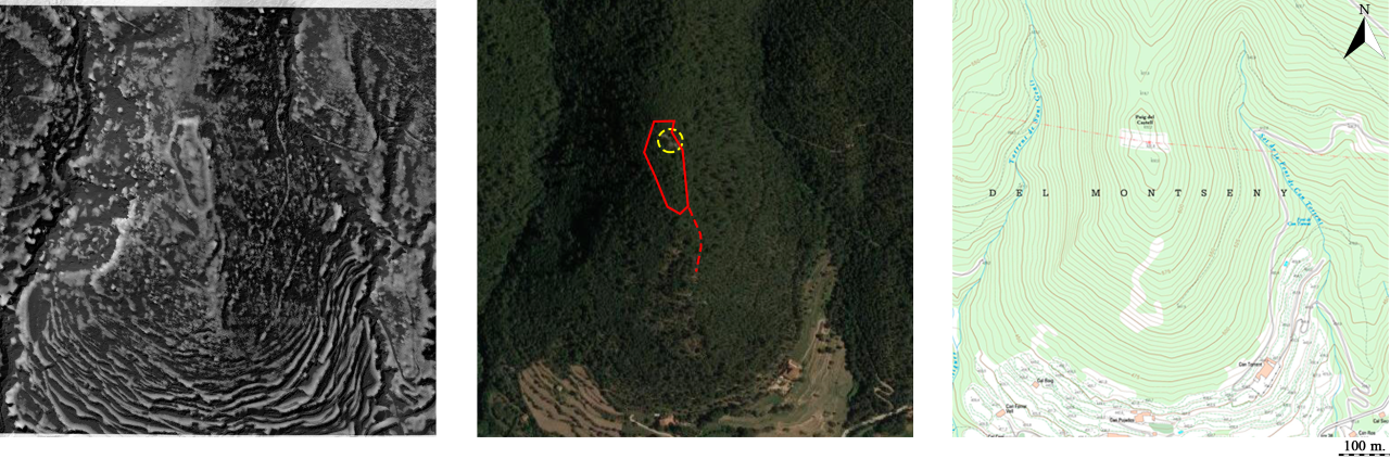
The new workflow has been able to detect th fortified walls of six Iberian Iron Age sites, located in Catalonia.
To test this approach, researchers have produced a series of DTM models using multitemporal LiDAR data from a series of Iberian Iron Age settlements from which architectural remains were detected on site but not thoroughly mapped. They all are in low mountain forested areas. The sites under investigation correspond to the settlements of Burriac (Cabrera de Mar, Maresme), Castell Barri (Calonge, Baix Empordà), Puig d’en Rovira (La Creueta de Quart, Girona), Puig Castell (Cànoves i Samalús, Vallès Oriental), Sant Miquel (Vallromanes/Montornès, Vallès Oriental), and Torre Roja (Caldes de Montbui, Vallès Oriental).
The paper published at Land has shown how the combined use of multitemporal lidar datasets and multiscale approaches to micro-relief visualisation can improve the visualisation of subtle archaeological remains present as micro-reliefs in the ground surface even in complex environments such as forested mountain Mediterranean areas.
This method has the potential to radically improve archaeological survey and the detection and analysis of microtopographic archaeological features.
Compared to previous research, the workflow shows notable improvements in the visualisation of the wall structures. The delimitation of the walls and the potential extension of the archaeological sites provides important new data as:
- It will allow to estimate the potential population and hierarchies between sites;
- It will allow the development of conscientious excavation planning, which can now focus on intramural areas and not waste efforts in potentially uninhabited sectors;
- . It will allow a much more informed heritage protection measures, which will be able to take into account the whole extension of the sites and not just the small sector where remains have been detected.
More importantly, the workflow has the potential to be employed for the combination and filtering of not just lidar but also different types of legacy point data such as DGPS, total, station or photogrammetry-derived point clouds. As such it provides an important new basis for the integration of data, which up to know had rarely been combined, that can be used for the development of accurate high-resolution DTMs.
Read the paper in open access:
Potential of Multitemporal LiDAR for the Detection of Subtle Archaeological Features under Perennial Dense Forest, Iban Berganzo-Besga, Hèctor A. Orengo, Joan Canela, Maria Carme Belarte, Land 2022, 11(11), 1964 (https://doi.org/10.3390/land11111964 – registering DOI).
Bibliography
Belarte, M. C.; Canela, J.; Orengo, H. A.; Berganzo-Besga, I. “Using LiDAR to detect architectural features in urban sites in the coast of Northern Iberia (6th – 3rd centuries BC). Preliminary results”, en: Belarte, M. C.; Noguera, J.; Plana-Mallart, R.; Sanmartí, J.; (eds.), Urbanización en Iberia y la Galia Mediterránea en el Primer Milenio aC, TRAMA 7, ICAC, Tarragona, 2020, vol. 1, p. 137-148 (http://hdl.handle.net/2072/417717).
Berganzo-Besga, I.; Orengo, H. A.; Lumbreras, F.; Carrero-Pazos, M.; Fuente, J.; Vilas-Estévez, B. “Hybrid MSRM-Based Deep Learning and Multitemporal Sentinel 2-Based Machine Learning Algorithm Detects Near 10k Archaeological Tumuli in North-Western Iberia”, Remote Sens 13, 2021, 4181 (https://doi.org/10.3390/rs13204181).
Guyot, A.; Lennon, M.; Hubert-Moy, L. “Objective comparison of relief visualization techniques with deep CNN for archaeology”, Archaeol. Sci. Rep 38, 392, 2021, 103027 (https://doi.org/10.1016/j.jasrep.2021.103027).
Orengo, H. A.; Petrie, C. A. “Multi-scale relief model (MSRM): a new algorithm for the visualization of subtle topographic change 390 of variable size in digital elevation models”, Earth Surf. Process. Landf 43, 2018, 1361-1369 (https://doi.org/10.1002/esp.4317).
Funding
This research was funded by the Spanish Ministry of Economy and Competitiveness, grant number HAR2015-67946-C2-2-P.
Internacional Conference Dolia ex Hispania. Dolia in the Hispania provinces in the Roman period comes to Tarragona this week
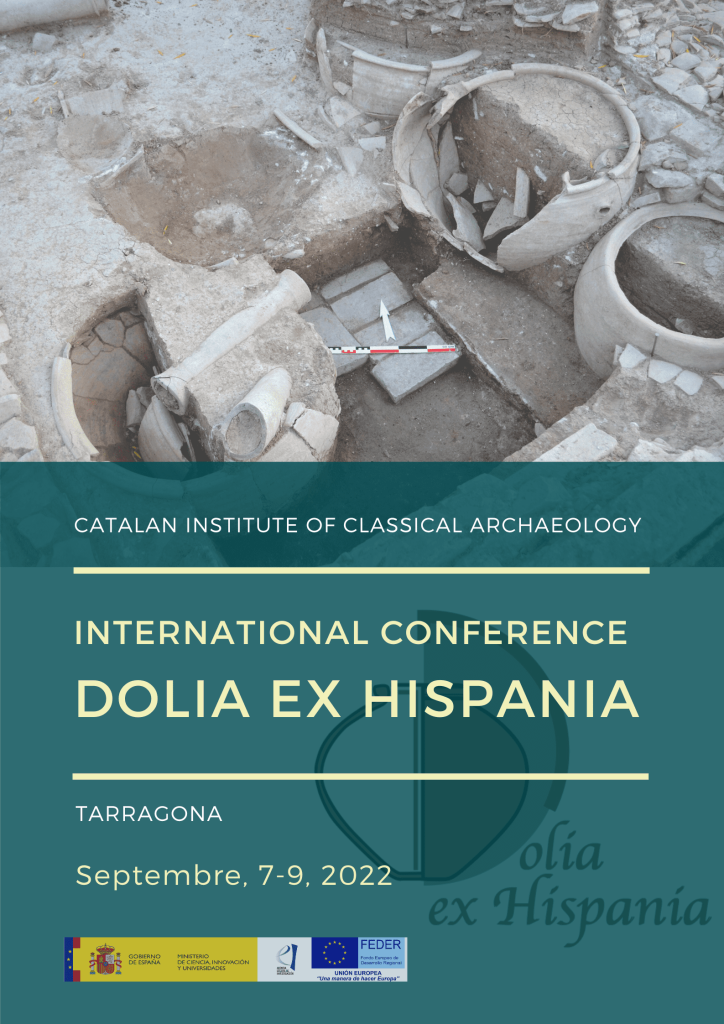
International Conference Dolia ex Hispania will bring together in Tarragona a hundred researchers from Spain, France, Portugal, Germany, Italy, Romania, and Morocco.
The event aims to dedicate a prime synthesis to the Hispanic dolia, within the framework of each of their provinces (Tarraconensis, Lusitania, Baetica) and therefore compile information that until now had been dispersed or unpublished. This scientific meeting will be compiling the results of recent archaeological research.
Internacional Conference Dolia ex Hispania aims to offer a scientific balance to promote later studies, creating an arena for discussion and collaboration between specialists.
ICAC Research team on Food, Economy and Trade in the Ancient World (Aecma) is organizing this conference, in the framework of the research project Figlinae Hispanae (FIGHISP). Catálogo en red de las alfarerías hispanorromanas y estudio de la comercialización de sus productos (PGC2018-099843-B-I00, MCIU/AEI/FEDER, UE).
The high volume of proposals submitted and the positive assessment made by the Scientific Committee of the conference have exceeded the initial expectations of the Organizing Committee, which has decided to extend the conference to a three-day event (instead of the two-day originally planned).
Dolia ex Hispania International Conference will hold 40 communications with the participation of one hundred researchers from 43 universities, research centers, and organizations from Spain, France, Portugal, Germany, Italy, Romania, and Morocco.
⇒ On-site sessions will take place at Serveis Territorials de Cultura de Tarragona.
⇒ There’s no room for more people to attend on-site but an open link is available to follow all sessions in streaming, online.
ICAC will edit a publication, within the series TRAMA, with a selection of the papers and communications submitted, after a peer-review process.
The event will be opened by the director of the ICAC, Josep Maria Palet, and the ICAC researcher Ramon Járrega, organizer of the congress, on Wednesday, September 7, at 9 a.m.
The conference will then begin with the opening conference by Dr. Charlotte Carrato (Mosaïques Archéologie), at 9:30 a.m.
From 10 a.m. to 6 p.m. there will be thirteen communications, corresponding to the Tarraconensis province section, which will begin with a talk by Joaquim Tremoleda (MAC Empúries) and Maria Rueda (ICAC) entitled “Dolia ex Tarraconensi”.
On Thursday, September 8, the conference will also dedicate part of the morning to the Tarraconensis province, with seven communications. The afternoon will be devoted to the Lusitania province, with nine communications that will begin with the presentation “Dolia ex Lusitania” (12:20 p.m.), by José Carlos Quaresma (University of Lisbon), Pedro Pereira (University of Porto) and Sonia Bombico (University of Évora).
On Friday, September 9, it will be the turn of the Betica province, which, with four communications, will begin at 9 a.m. with the presentation “Dolia ex Baetica“, by Dario Bernal (University of Cádiz), Enrique García and Iván González (University of Seville), and Oriane Bourgeon (ICAC).
Later on, Friday, starting at 11 am there will be the last section, called section varies, in which there will be room for six communications on dolia with themes not limited to a specific Roman territory or province. After the debate, the conference will come to an end with a closing conference by Dr Yolanda Peña (UNED), at 1:20 p.m.
La #HispaniaTarraconense fou una gran regió productora de vi, tal com testimonia la troballa d’un gran nombre de cellae vinariae a l’actual Catalunya, zona de Llevant i Navarra.
En parlarem amb @mruedapr al congrés #doliaexhispania 😉
📷 #dolia conservats al soterrani del #MUHBA pic.twitter.com/jJu3QbBAEA— ICAC, Institut Català d’Arqueologia Clàssica (@ICAC_cat) August 24, 2022
Dolia in the Hispanic provinces in the Roman period
Facing the new demands of an expanding Roman Empire, from I AC century there was a gradual transfer of production between Italy and its provinces. In this context, the Iberian Peninsula and the South Gaul occupied a primordial place in supplying the Imperial centre, until well into the III AC century. Beyond the fertility of their lands and a favourable climate for Mediterranean crops, these provinces, endowed with extensive coastlines and navigable waterways, offered new commercial opportunities to meet the needs of the rest of the empire, thus establishing large-scale production. scale among which wine and oil were the most emblematic products.
Un #dolium era un recipient de grans mides usat en època romana per a emmagatzemar productes alimentaris. A l’actual Catalunya es testimonia sobretot en cellers, per ajudar en la vinificació i emmagatzematge del vi.#DoliaexHispania #Arqueoparaules #Aecmahttps://t.co/OIVDJLWoOO pic.twitter.com/KzeRLkPqlJ
— ICAC, Institut Català d’Arqueologia Clàssica (@ICAC_cat) July 7, 2022
The agricultural production in the aforementioned areas, partly organized by Italian settlers, benefited from the techniques introduced by those newcomers. Among the newly implemented tools, the dolium gained a primary role in the vinification and oil decanting processes, along with a general food storage function. Although the recipient had other secondary usages, the primary role was, without doubt, linked with the mentioned wine and oil productions.
Els #dolia eren molt difícils i costosos de fabricar, per aquest motiu tenien una vida útil molt llarga. De fet, en cas de trencar-se es reparaven amb grans grapes de plom.#doliaexhispania
📷 Detalls de les grapes d’un #dolium conservat al @MNATTGN.@mruedapr #Aecma pic.twitter.com/8ZpqOZs5mH— ICAC, Institut Català d’Arqueologia Clàssica (@ICAC_cat) August 5, 2022
On-site sessions will take place at Serveis Territorials de Cultura in Tarragona. There’s no room for more people to attend on-site but an open link is available to follow all sessions in streaming, online.
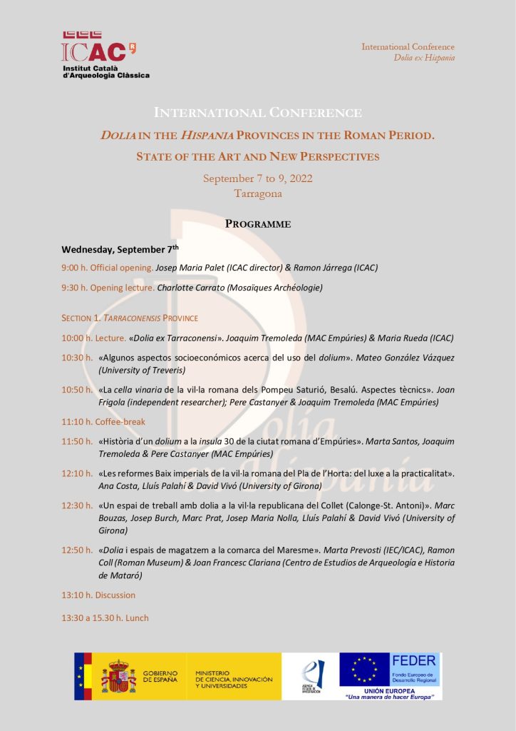
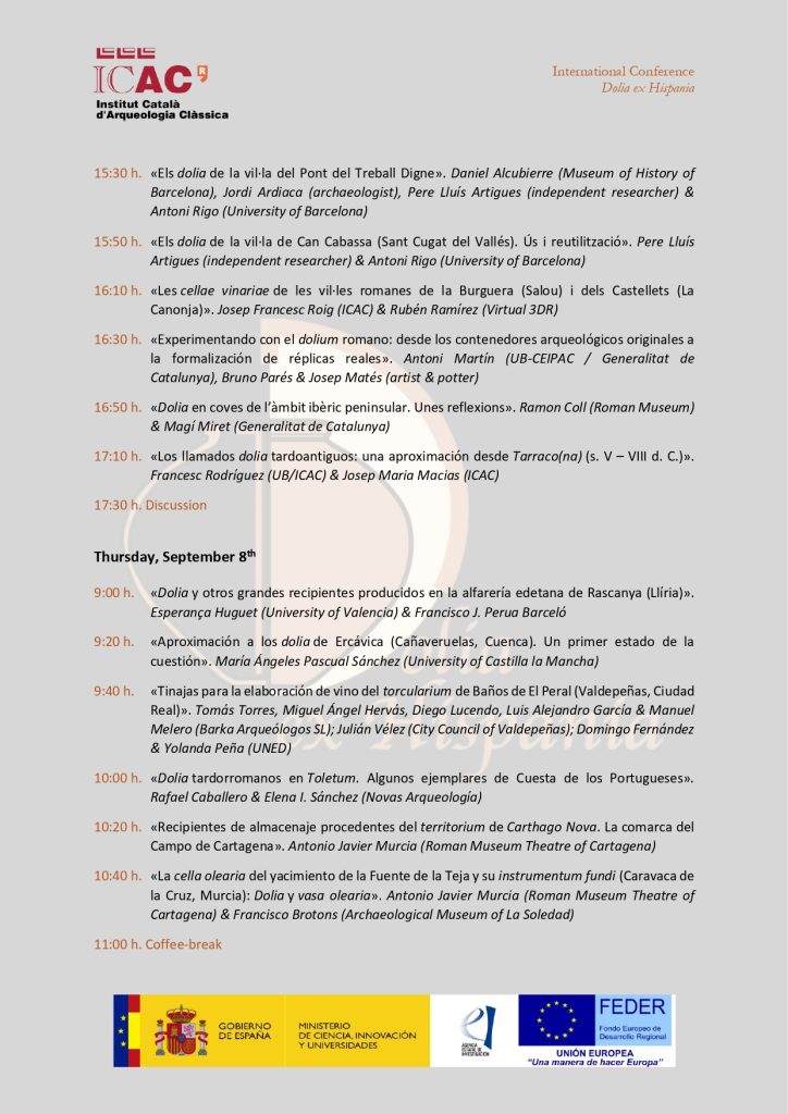
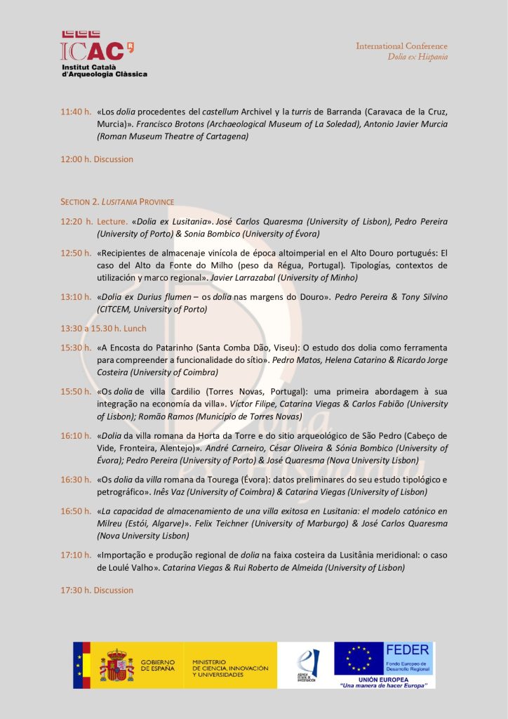
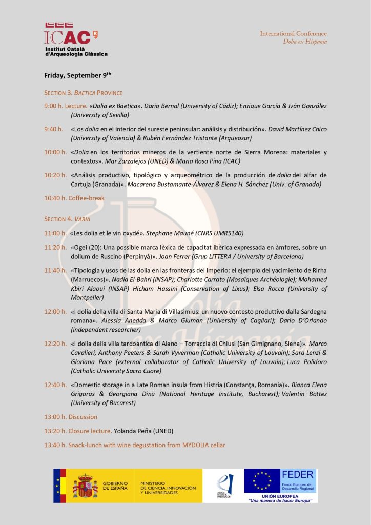
Programme:
Funded by:
With the collaboration:

La represa de les excavacions a Alto Chacón (Teruel) permet descubrir diversos forns adossats a la muralla
La troballa s’ha produït mentre es buscava l’accés principal al poblat, del qual s’ha pogut datar un moment àlgid entre els segles III i II aC.
Aquest juliol ha finalitzat la primera campanya arqueològica d’una nova fase d’intervencions arqueològiques al jaciment de l’Alto Chacón, situat a uns 4 km de Terol. Aquest jaciment arqueològic es troba a quasi 1000 m d’altura i abasta un ampli monticle amb forma d’altiplà i una superfície de vora els 10.000 m2.
Es tracta d’un assentament emmurallat, amb torres i reforçat amb una fossa pels costats sud i est (els més accessibles). El jaciment compta amb una extensa vida, amb una ocupació des del segle V aC al segle I dC, si bé, tenint en compte els estudis realitzats fins ara, el seu moment àlgid sembla situar-se entre els segles III – II aC.
Els primers treballs arqueològics al jaciment es van desenvolupar sota la direcció de Purificación Atrián, directora llavors del Museo Provincial de Teruel, entre 1969 i 1972. Es va excavar una àrea d’uns 750 m2 en què es van identificar diferents estances que podrien pertànyer a uns 8 o 10 habitatges i dos carrers.
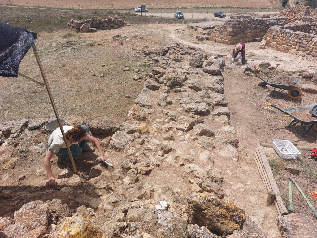
Les restes excavades durant la primera fase de la intervenció van ser restaurades i avui dia encara són visibles. Entre els anys 2005 i 2006 el Museo Provincial de Teruel va promoure una nova fase de restauració, a més d’una museïtzació i adequació del jaciment per a la visita lliure.
Els treballs arqueològics a Alto Chacón aquest 2022 s’han dut a terme entre els mesos de maig i juny.
Malgrat les actuacions arqueològiques dutes a terme al jaciment de l’Alto Chacón (Terol), el desconeixement sobre aquest poblat és acusat. A causa d’això, hi ha una aposta per la seva visibilitat i atractiu turístic (el jaciment es troba a escassos quilòmetres de la ciutat). Serà de nou el Museo Provincial de Teruel qui, al seu programa d’excavacions arqueològiques anuals, inclogui l’Alto Chacón en els seus projectes de recerca, sota la direcció de les arqueòlogues Marta Pérez Polo (Universitat de Navarra) i Marta Blasco Martín (ICAC, Equip de recerca en Arqueologia Protohistòrica). Les intervencions al jaciment compten amb la col·laboració de l’Institut Català d’Arqueologia Clàssica i l’empresa Iniciativas Culturales y Turísticas S. L.
Les prospeccions geofísiques, aplicades a l’exploració del subsol, han revelat part de l’entramat urbà i han permès planificar els treballs d’excavació arqueològica. La campanya 2022 s’ha centrat en dues zones concretes del jaciment, amb l’objectiu d’obtenir una seqüència cronològica precisa i determinar l’accés del poblat i la seva relació amb el sistema defensiu i viari.
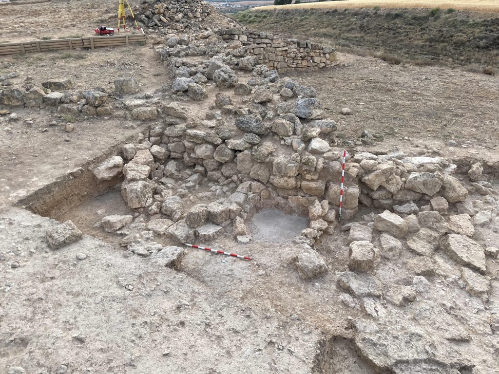
En una primera fase, l’equip dirigit per Pérez i Blasco ha treballat en un habitatge del poblat, amb accés mitjançant escala i separació interna amb una paret mitgera de tova. En aquest espai s’ha corroborat que el moment àlgid del poblat se situa entre els segles III i II aC i que, en les darreres fases de vida, es va poder reduir la seva extensió i centrar-se en algun punt concret del poblat. A més, s’ha documentat una llar, parament ceràmic i el residu alimentari característic d’un hàbitat domèstic.
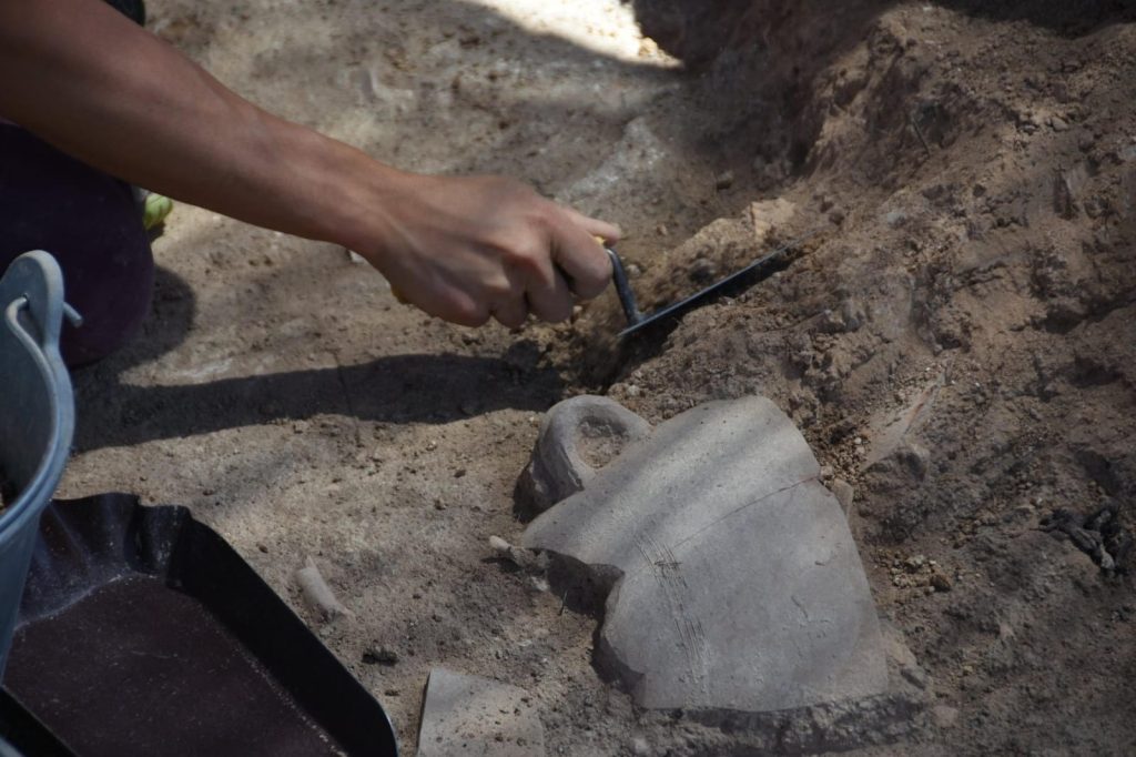
En un segon àmbit d’actuació, s’ha desvetllat un tram de muralla i una torre i s’ha treballat en el possible accés al poblat, reformulat en algun moment, tal com indica l’aparició d’una zona de producció amb diversos forns adossats a la muralla.
El retorn de les actuacions i els estudis arqueològics al jaciment d’Alto Chacón (Teruel) posen de nou l’accent en el potencial d’aquest poblat. Des del punt de vista de la investigació, és cabdal la seva ubicació estratègica, en un lloc de frontera entre les àrees de la vall de l’Ebre, la Meseta i la costa llevantina, on és present la confluència de la cultura ibera i celtibera.